KVR Day 15 – Elko to Fernie

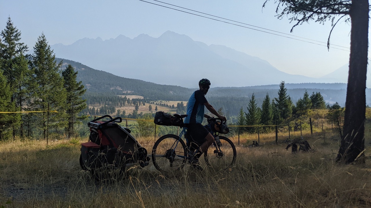
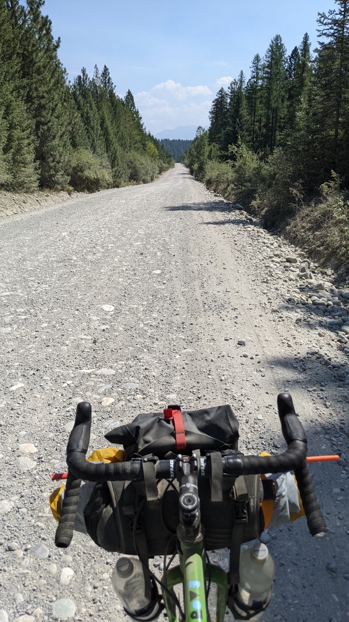
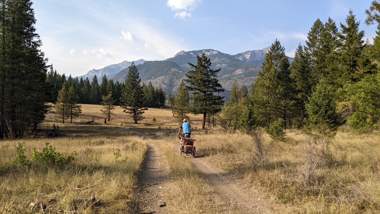
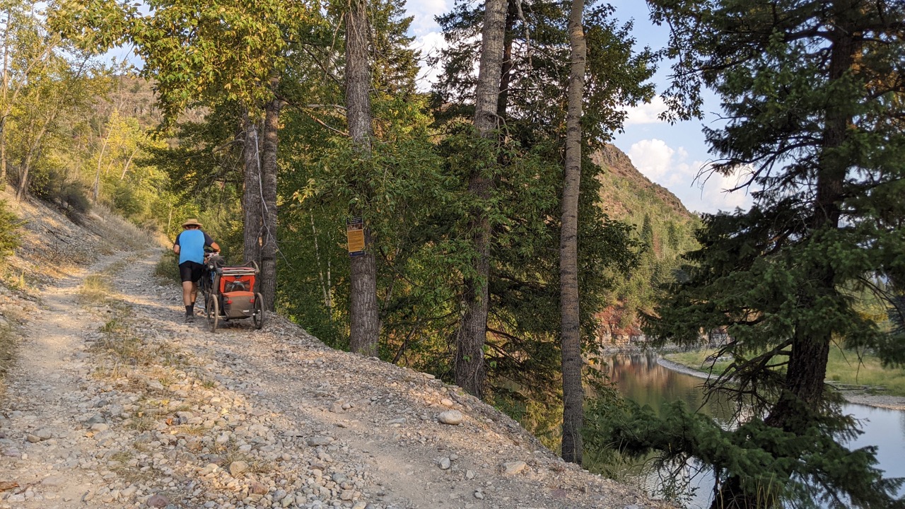
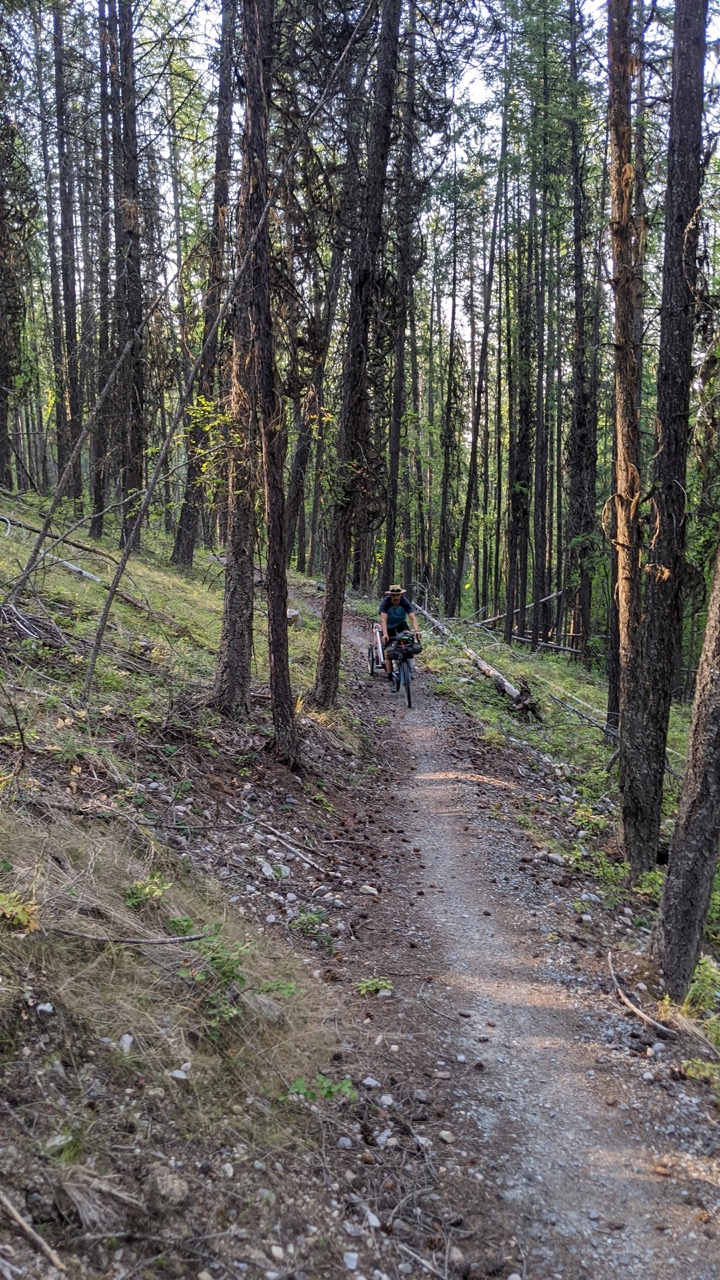
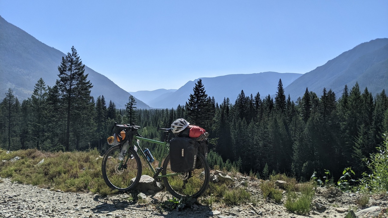
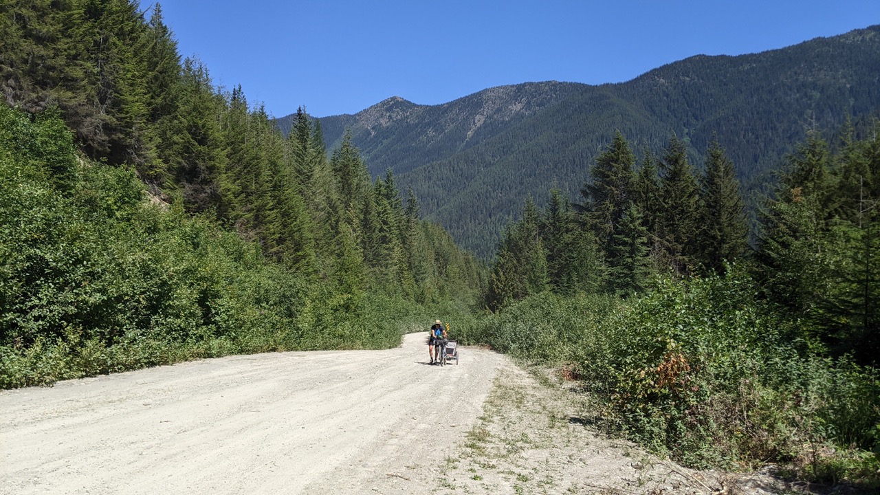
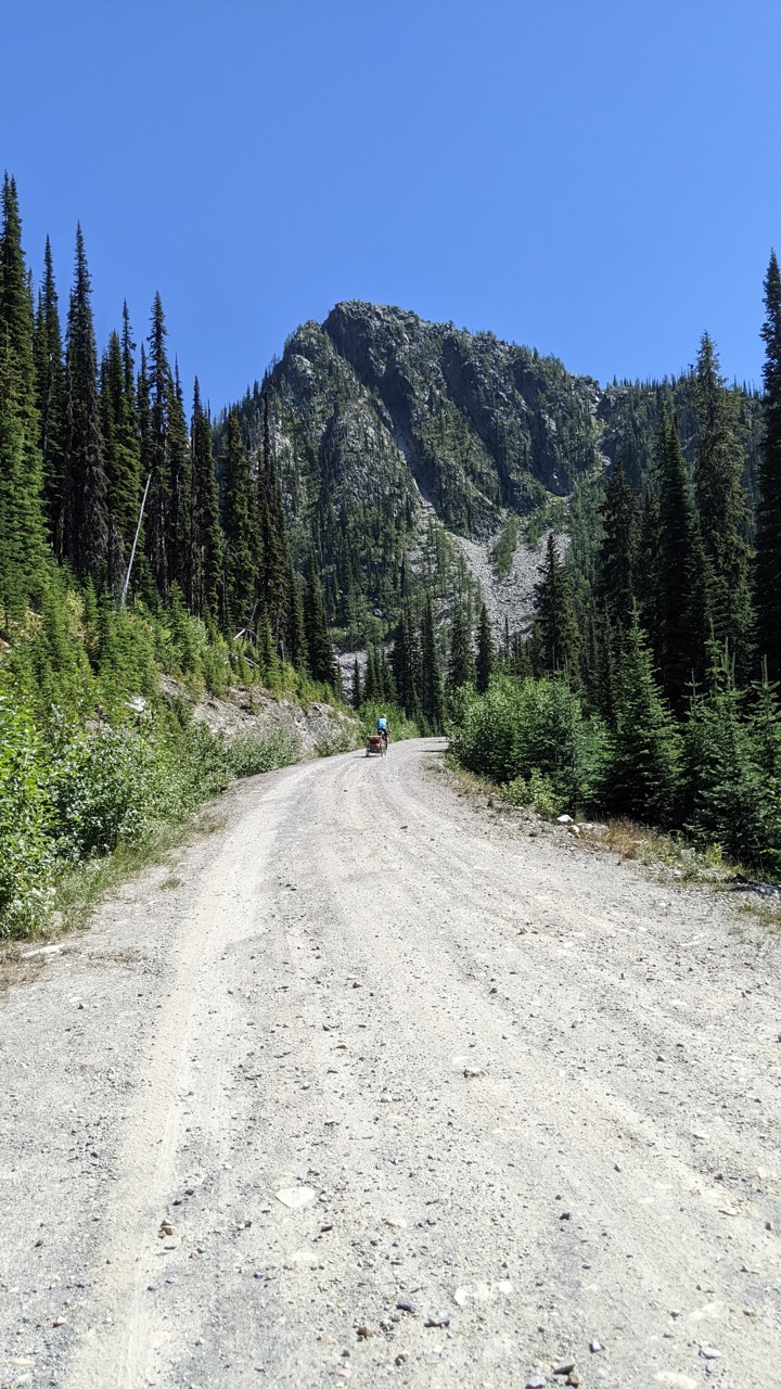
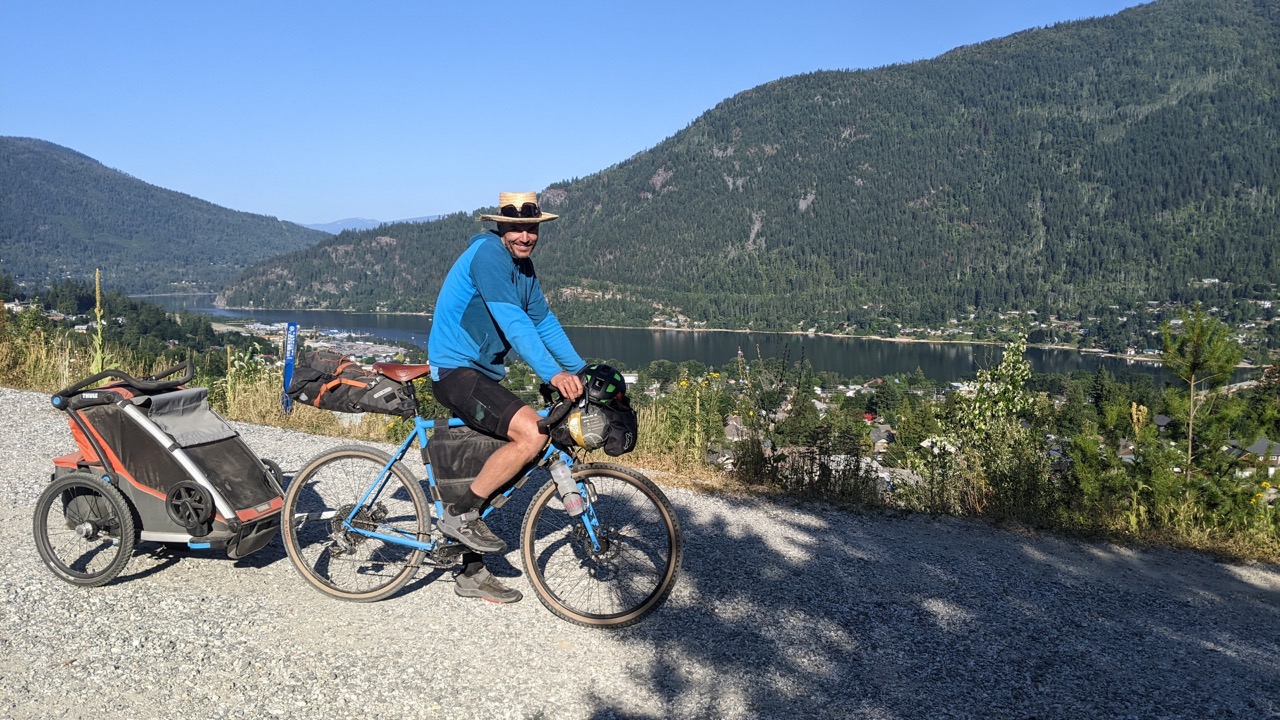
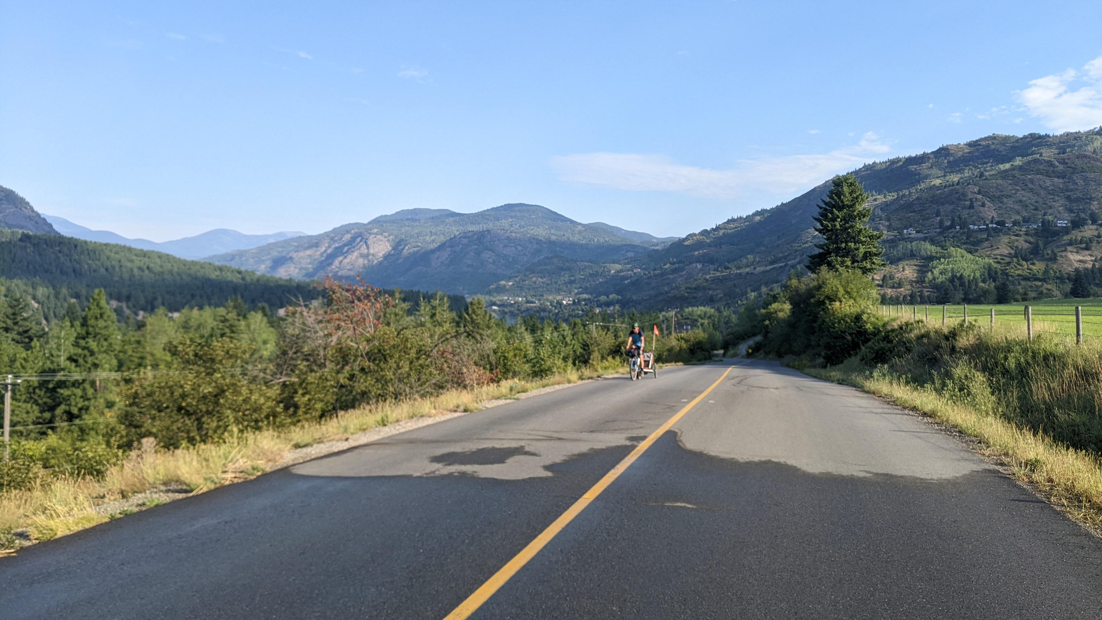
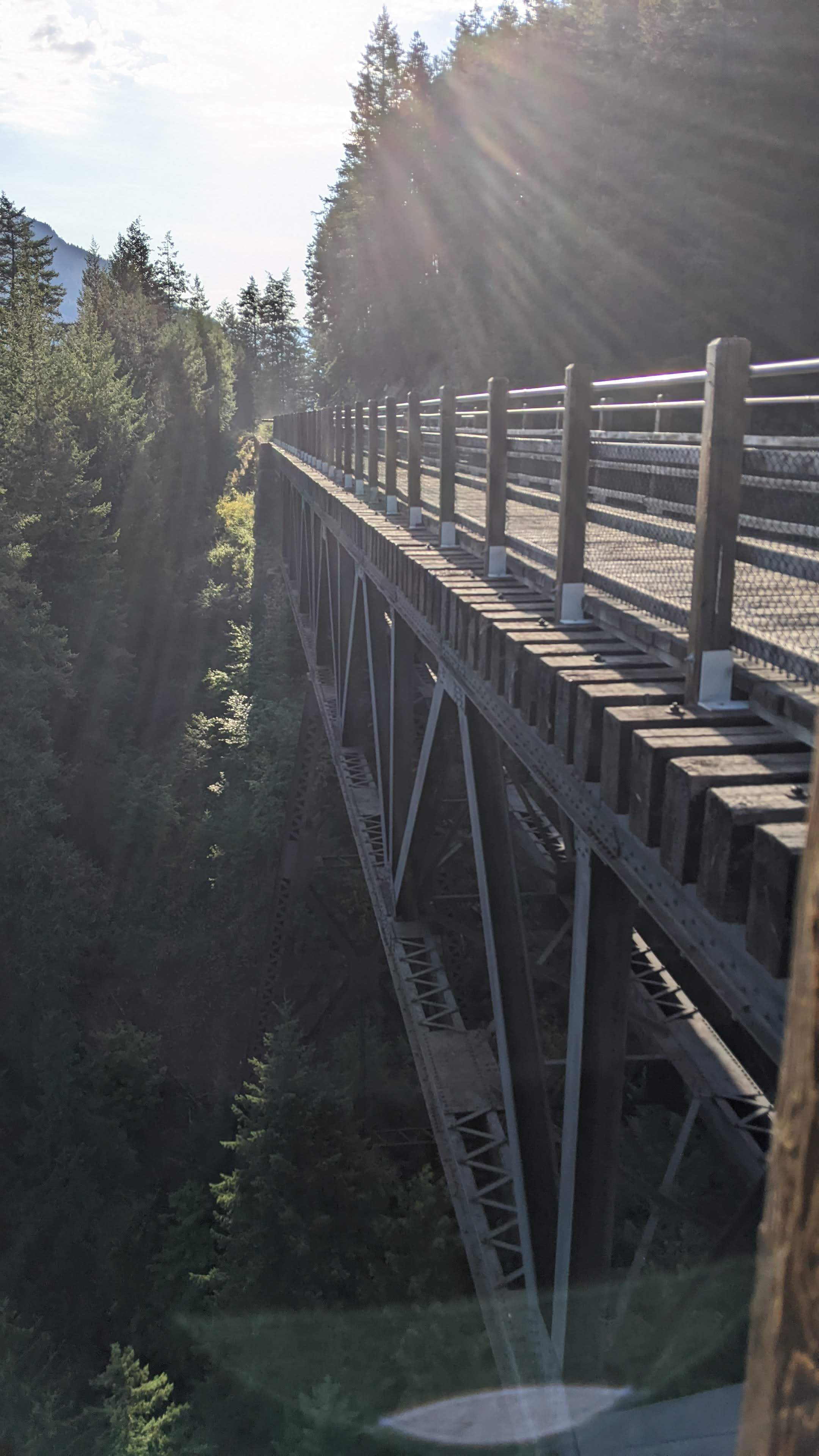
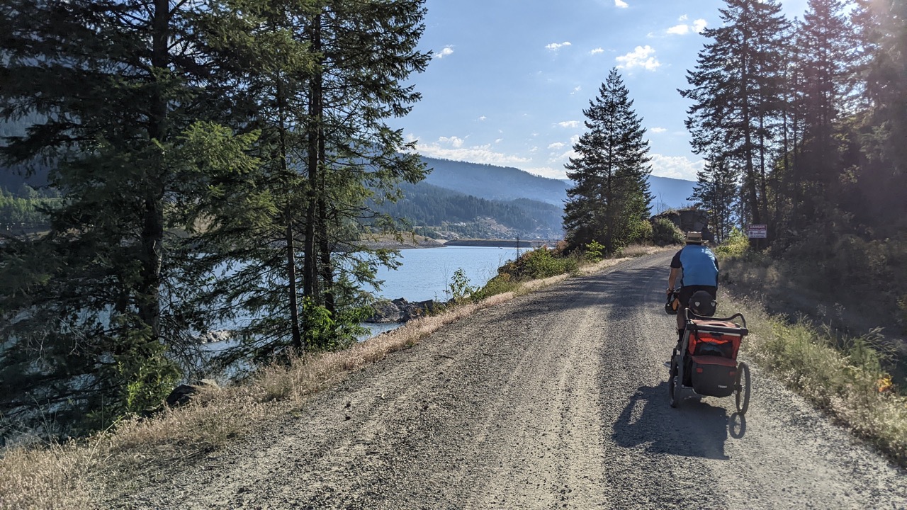
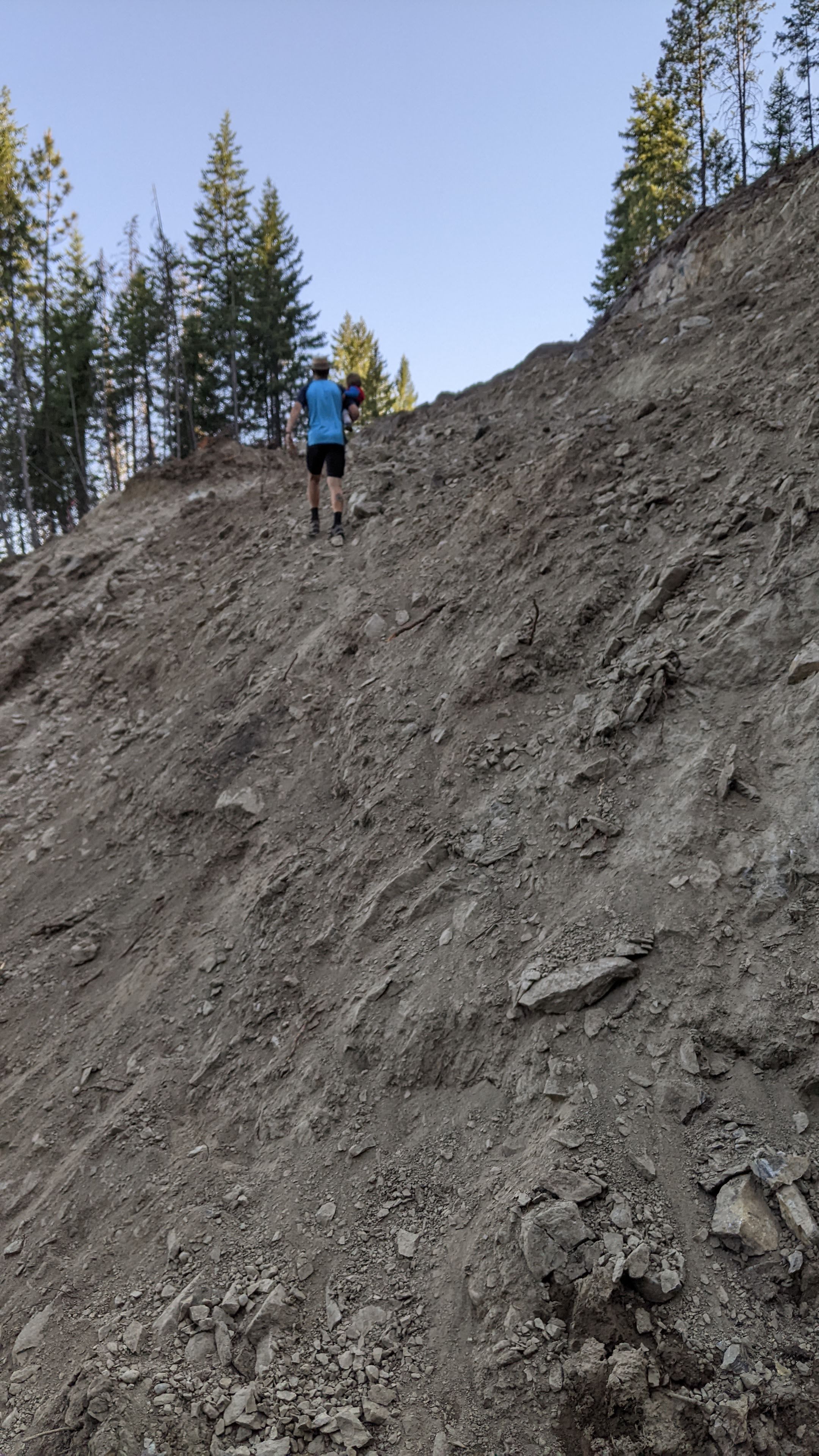
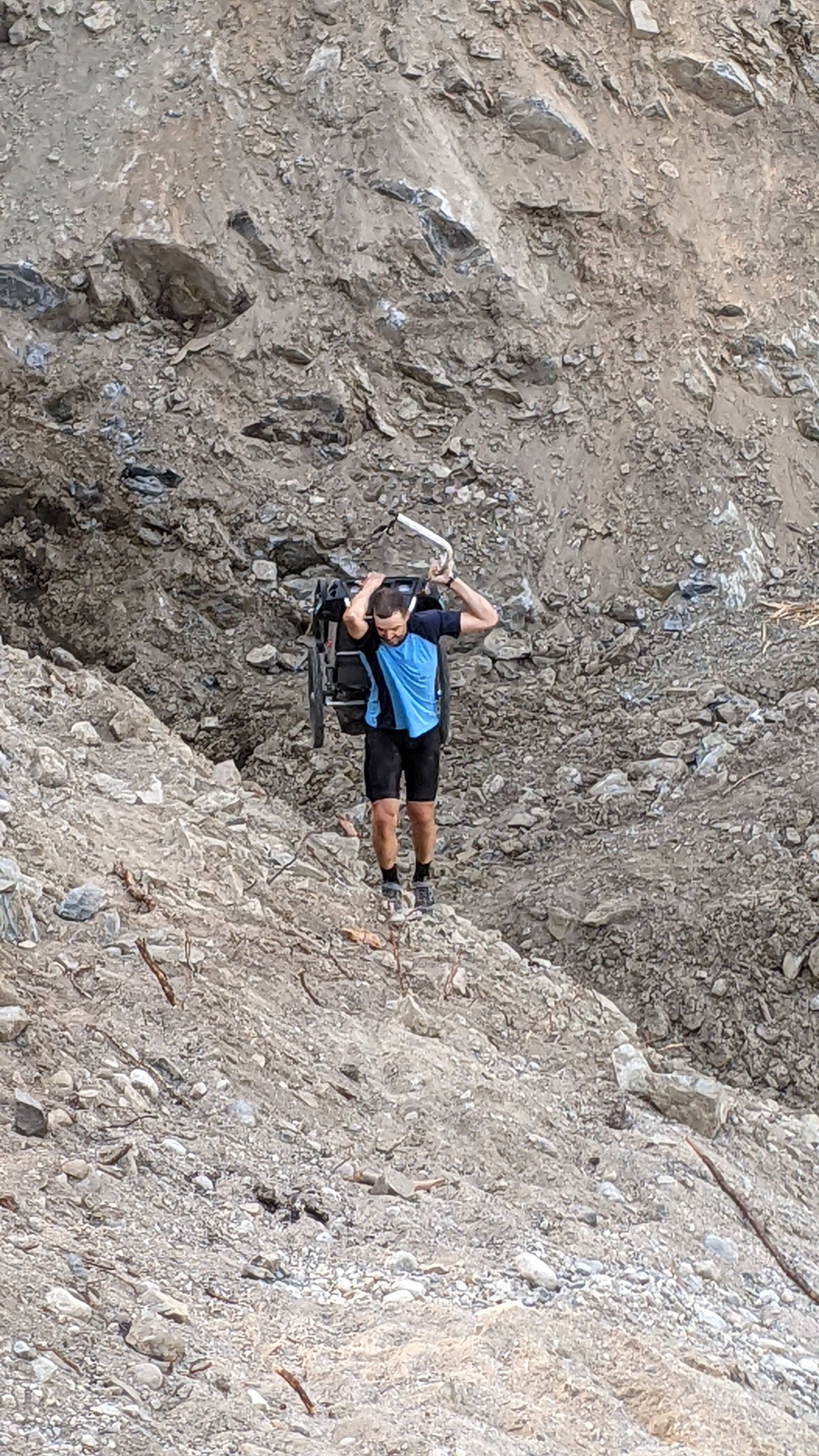
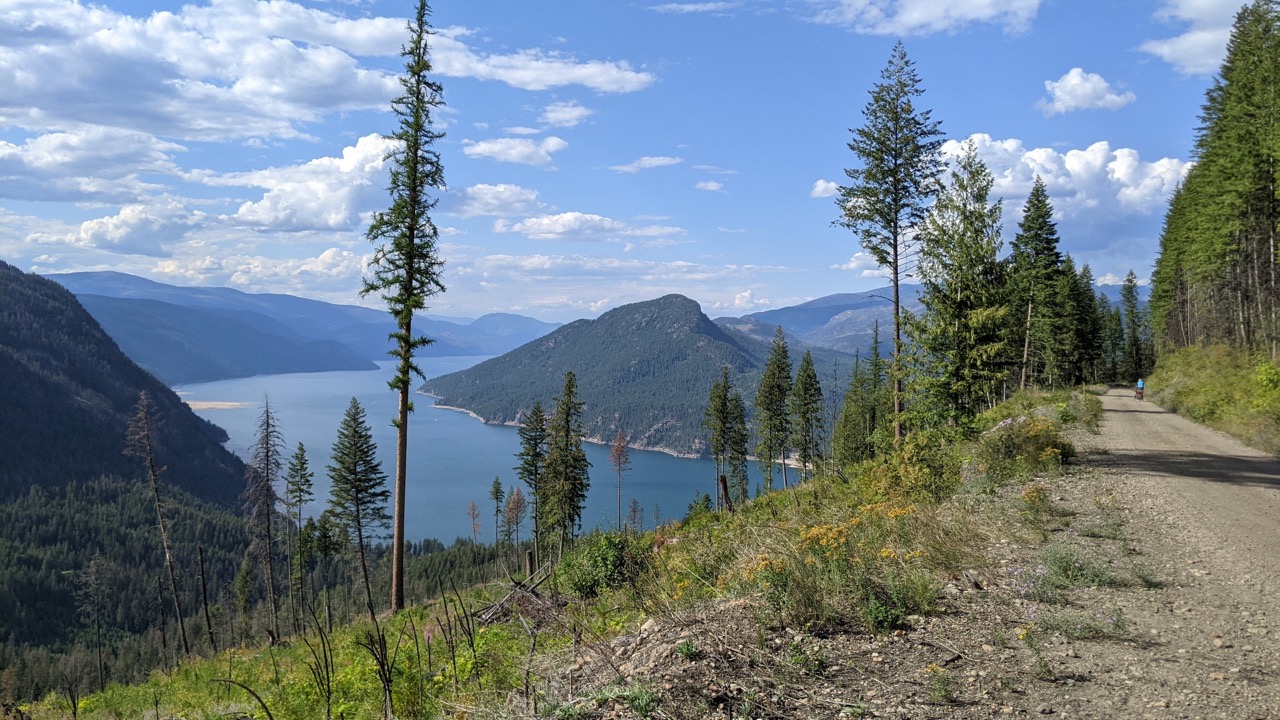
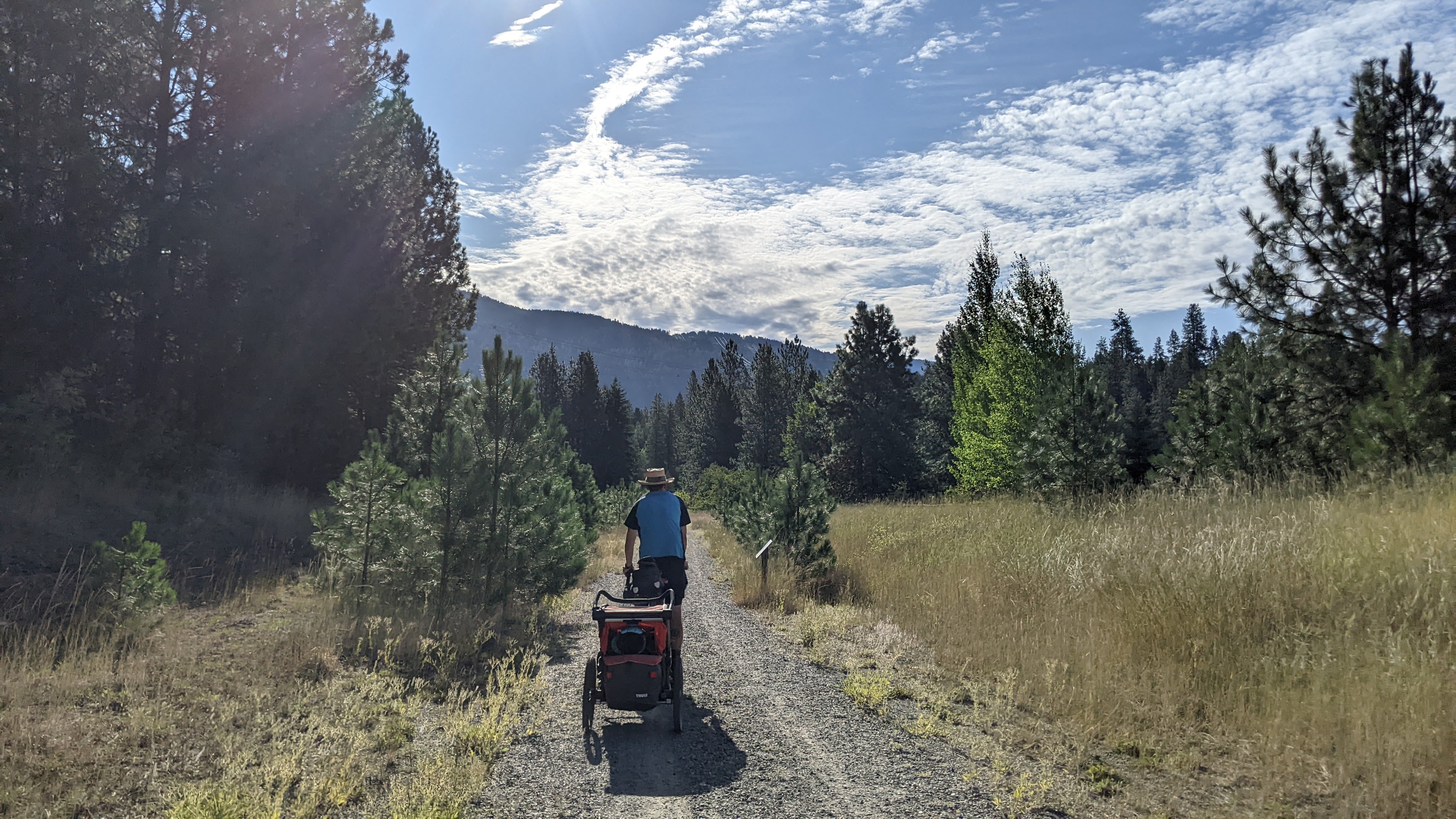
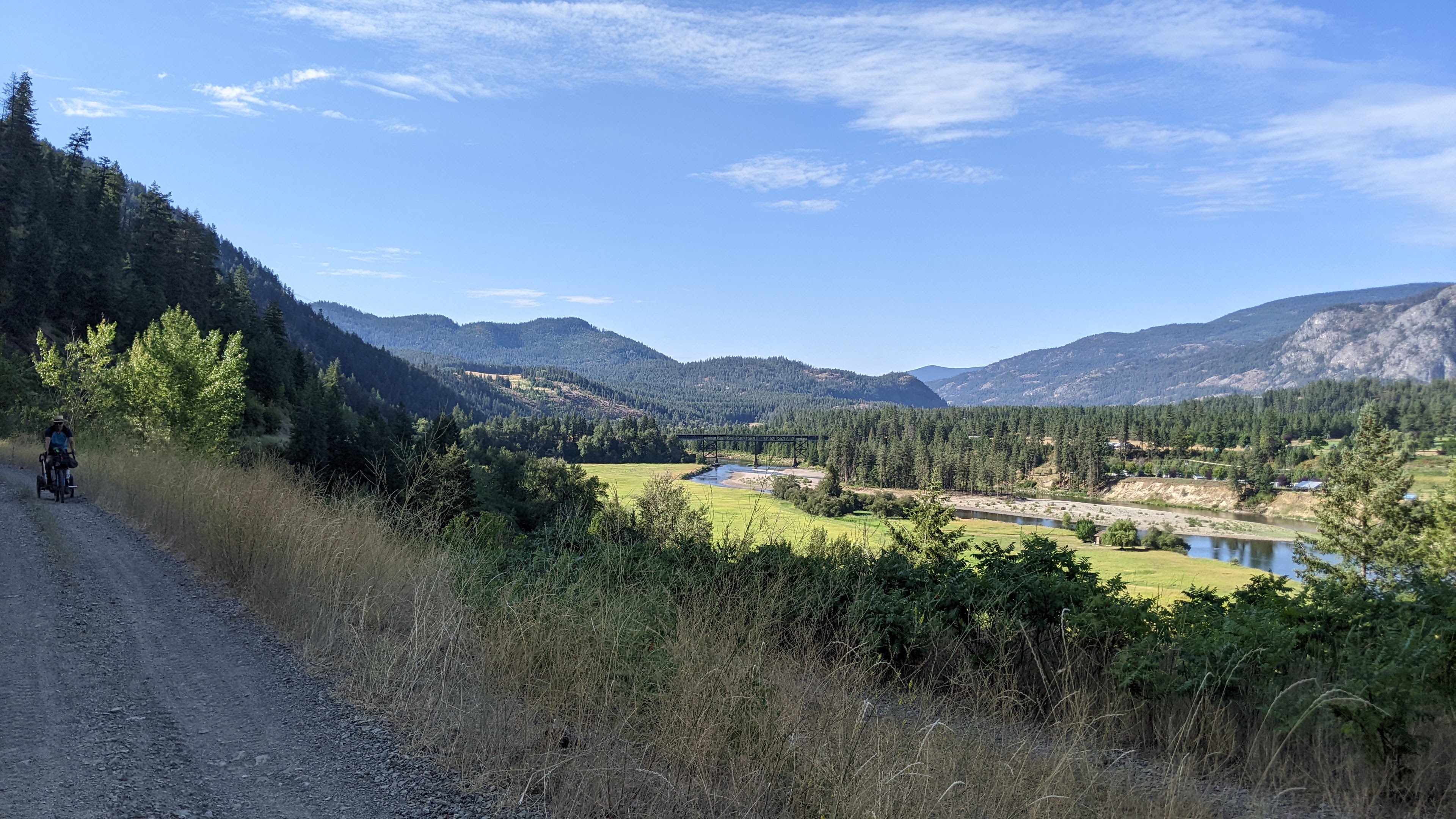
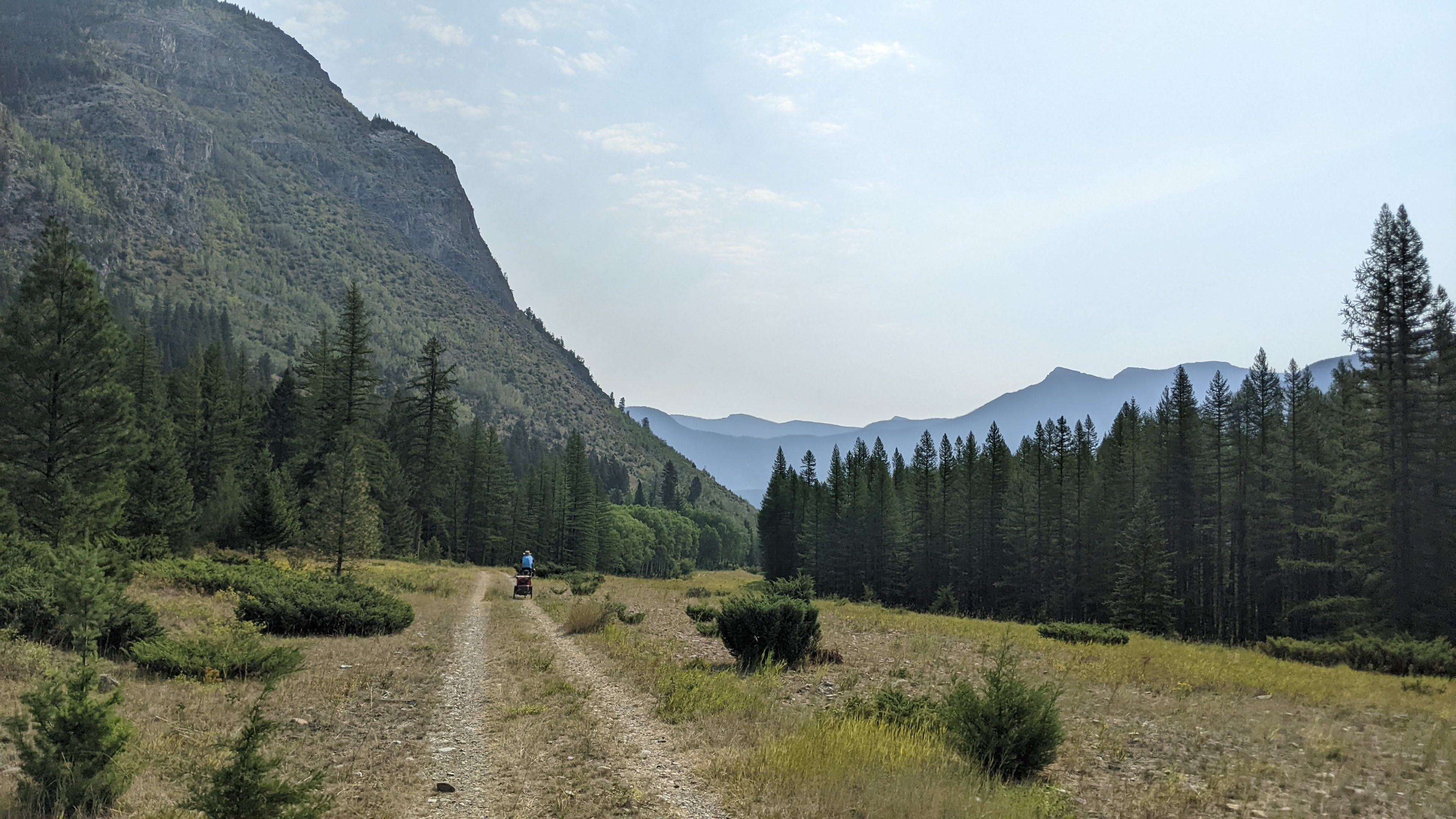
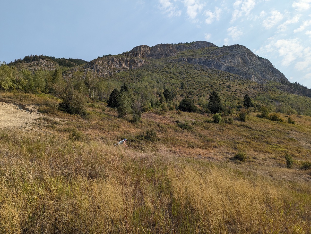
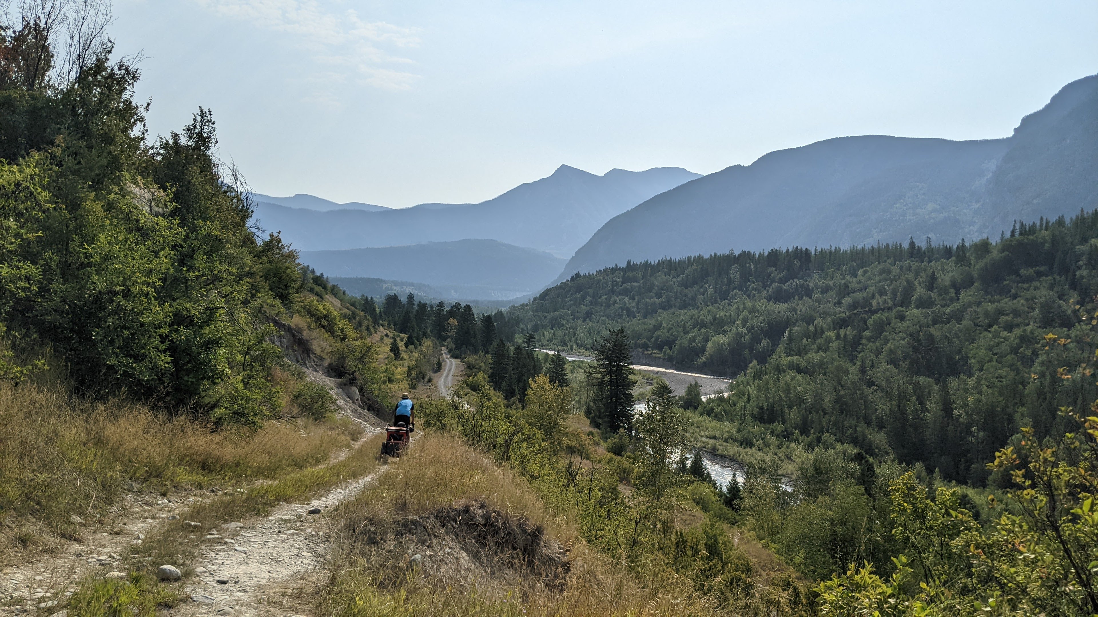
It took 2 of us to push Ryley’s bike and the chariot up steep/loose trail above Elk River, but at the top we rode along a plateau under Mt Broadwood and it was stunning – my favourite views yet. Down to the Wigwam River Forest Service Road, another significant climb, almost ran out of water, and more gravel that was supposed to be pavement before we rolled into Fernie mid-afternoon – the final destination of this adventure (for now)!

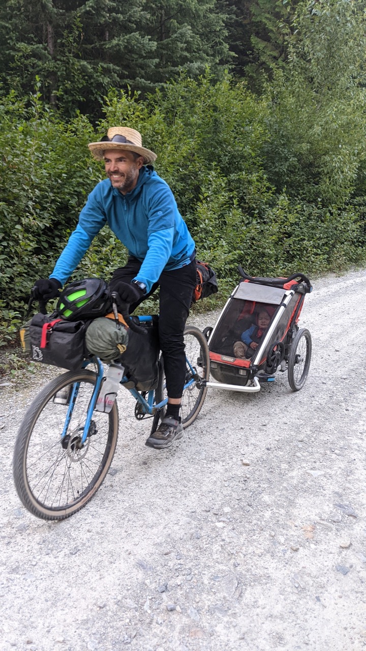
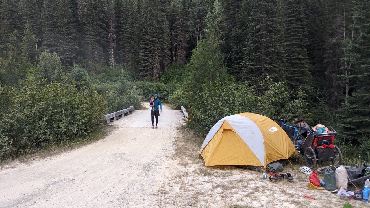
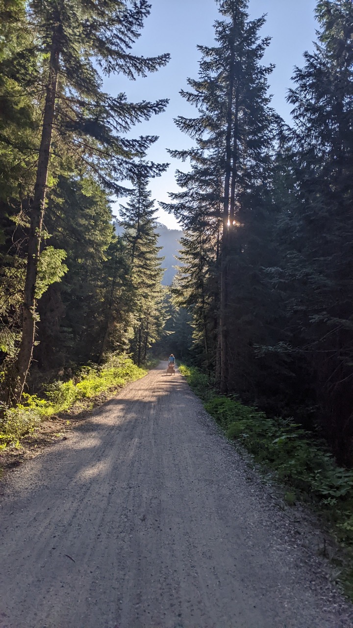
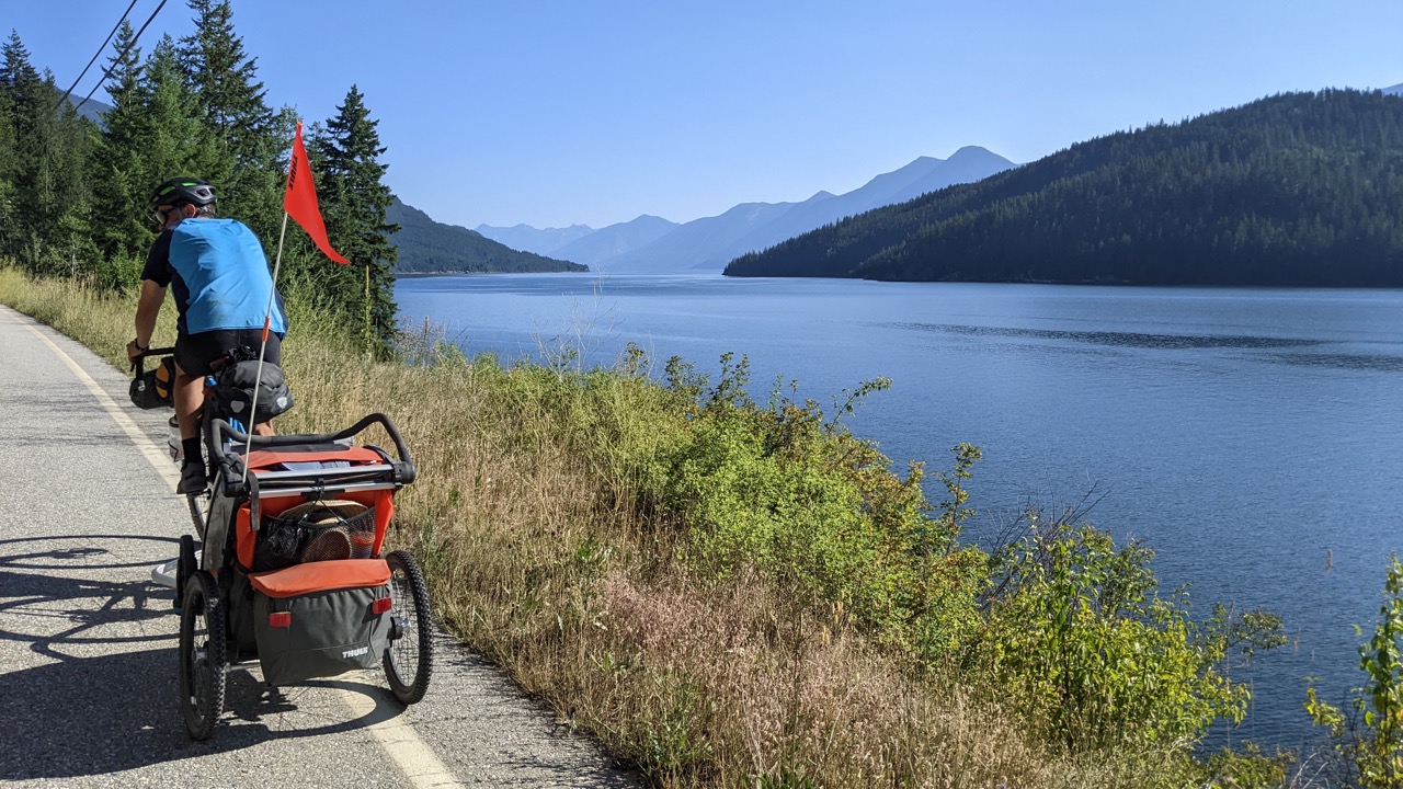
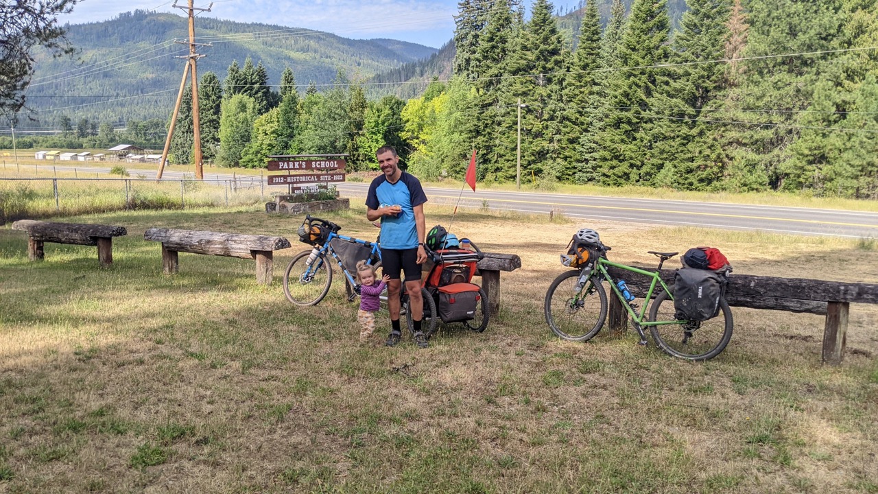
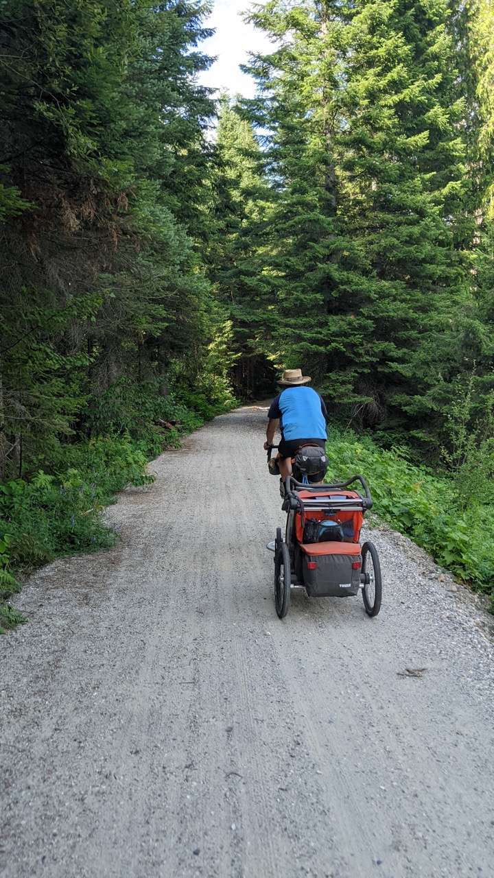
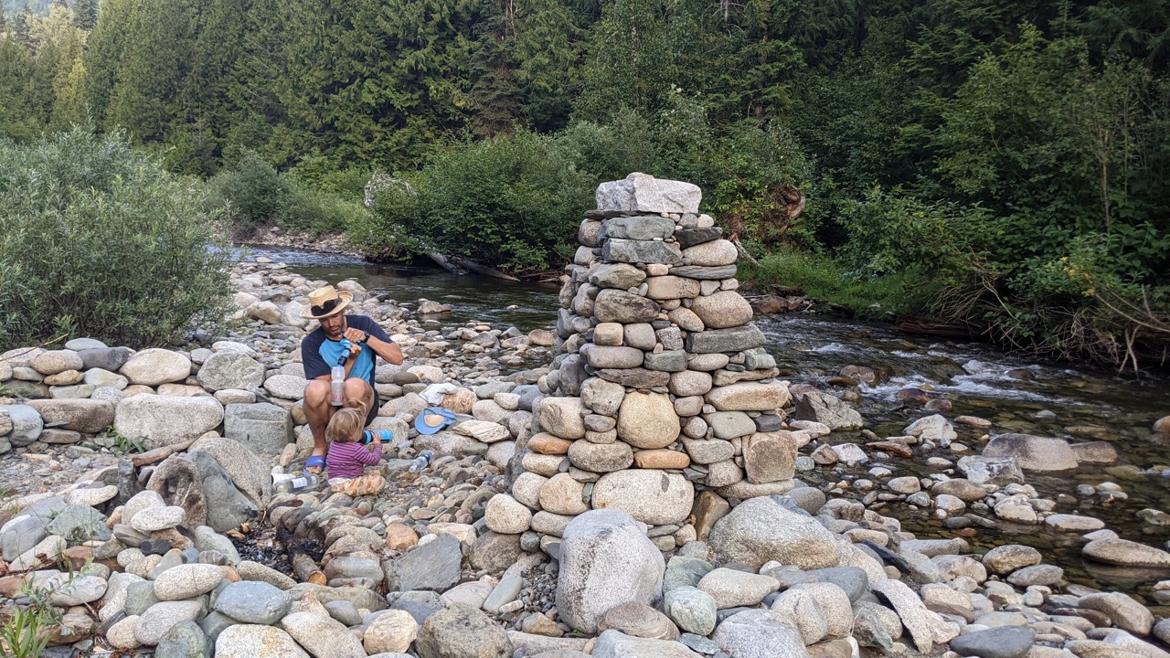
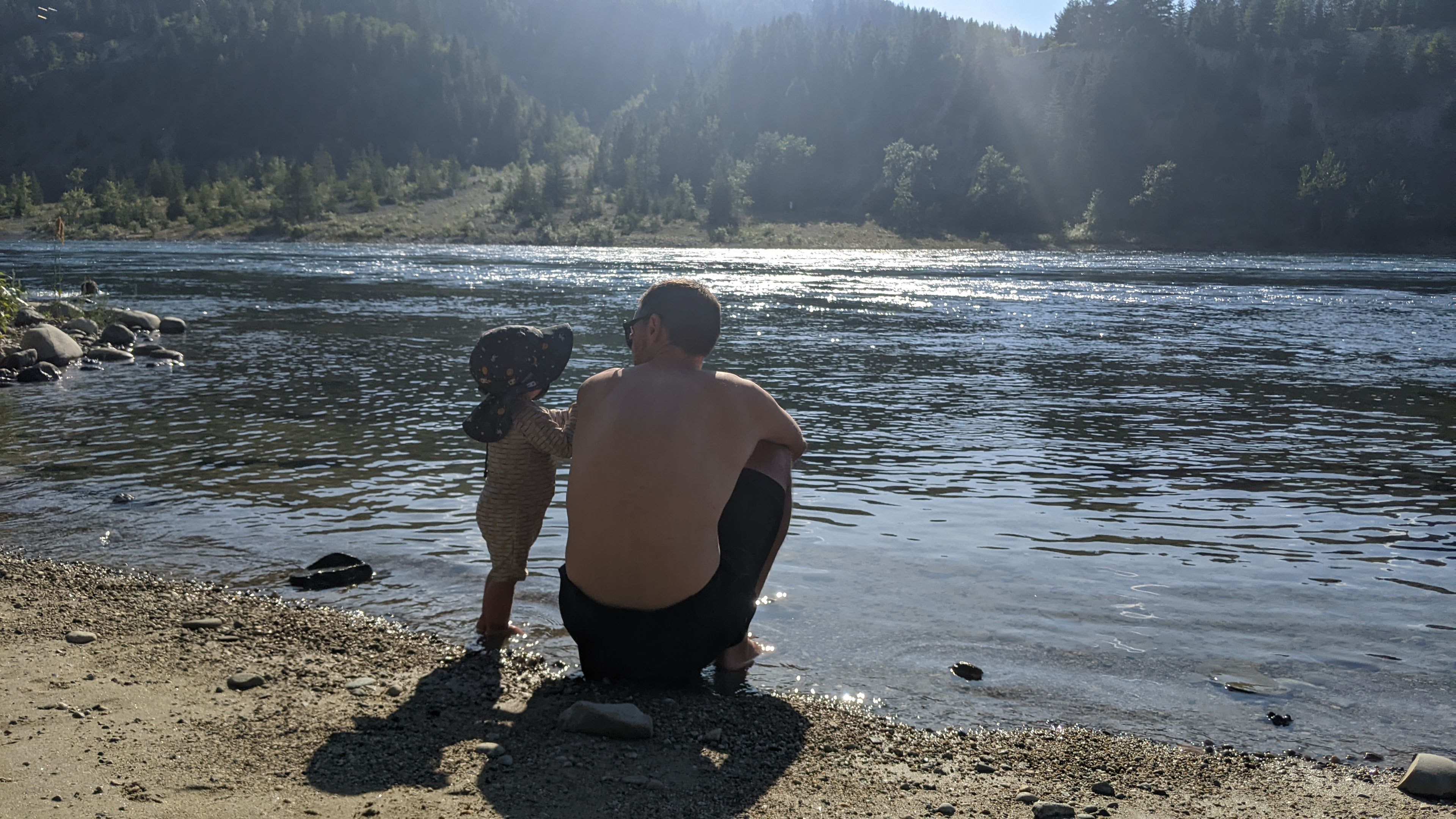
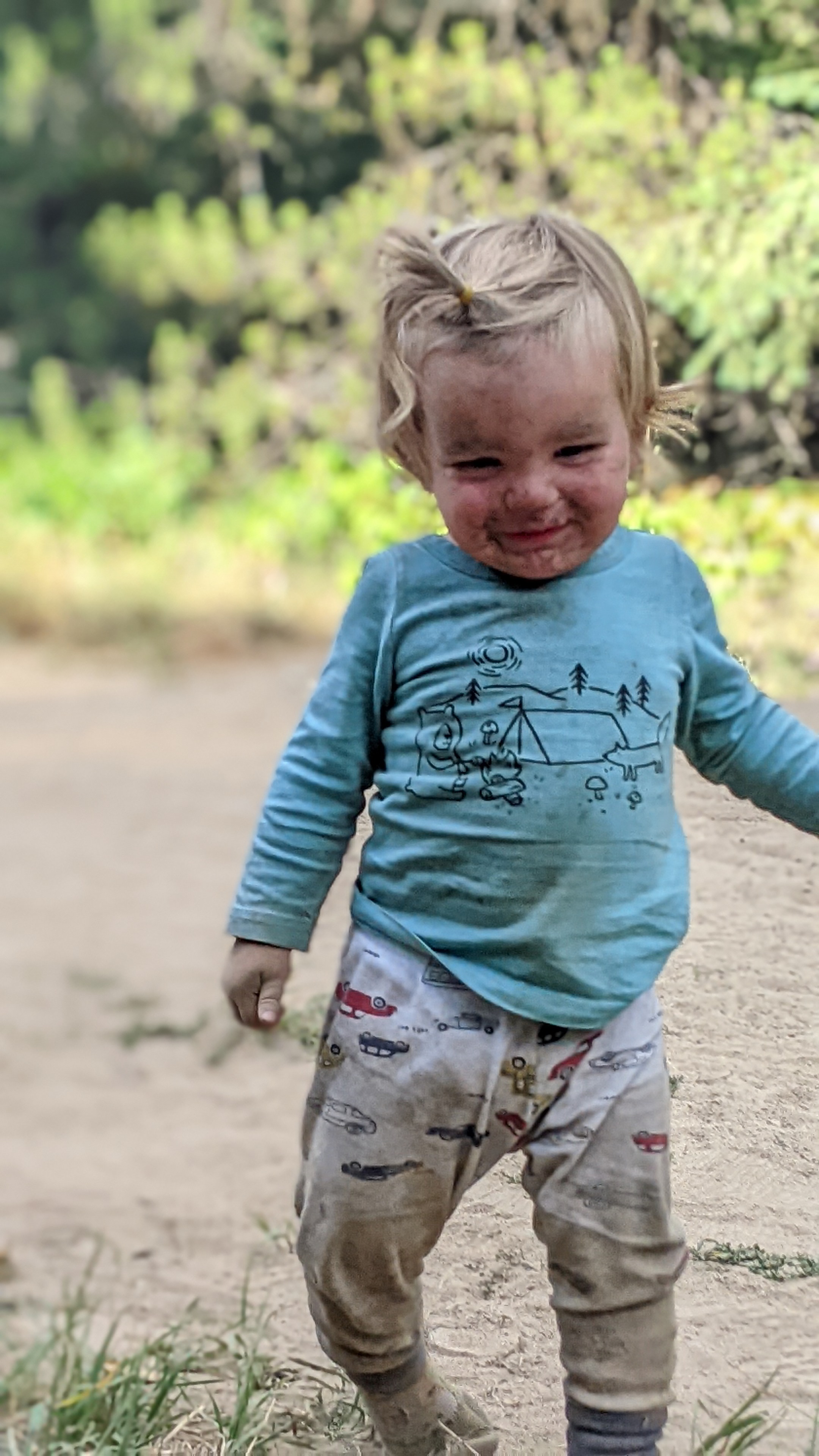
More 🚲!: Because it’s Saturday of the long weekend, the mill shut down its operations around 10:30pm the night before and was replaced by the sound of the river – that was a nice upgrade. Axel also slept in this morning, yay for us 🙂 We climbed immediately and steeply out of camp, with stunning views of the Elk River running through its canyons. I had to drop my bike and help push the chariot while Ryley pushed his bike up 2 of the steepest, loosest hills, then shuttled back to push my bike up (tough going!). The climbs put us up on a plateau under Mt. Broadwood – a 9000ha conservation area and my favourite views of the trip. A steep descent down (which needed 2 of us again on Ryley’s bike with the trailer) put us on a road following the Wigwam River, merging onto another Forest Service Road and with 2 more climbs of the day to go. More promised paved road that was of course gravel, and bumpy, meant a rougher finish on our final day than we’d hoped (but not necessarily than we’d expected!). It was around 3pm when we hit pavement coming into Fernie and stopped at the first pub we saw for a beer and a salad. We carried on to the Fernie City Hall to make our finish official before riding 3 more km to a hotel where we unpacked, showered, and hit the pool with Axel. There was a water slide which Axel flipped between “all done all done all done” (and looking concerned) to “more more more” (and looking quite excited). We took him down about 6 times between us and were both finding the stairs a real challenge by the last couple of laps! We welcomed Jaimie from a long drive from Penticton to pick us up, had Indian food for dinner, and called it a night!

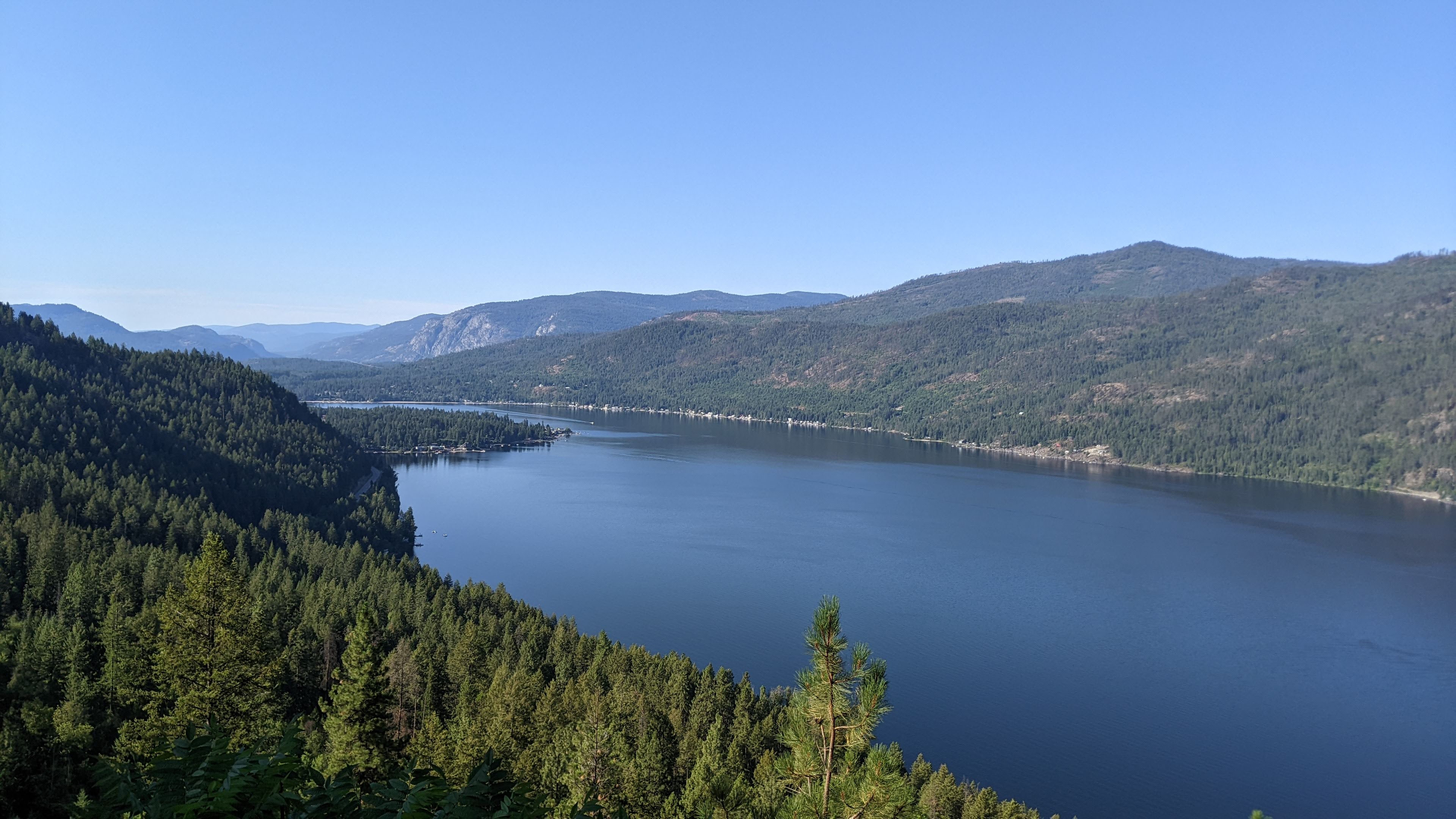
Side note: The 7h drive back went quite quickly and it was neat to see all the places the trail paralleled or crossed the highway. We’d carefully planned our drive home the next day to stop at all the best snack/food places, so we revisited Christina Lake, Greenwood (the bakery was open but all sold out of butter tarts! what a bust!), and Rockwood (for another coffee milkshake). Verdict? Nothing tasted as good as when we’d rolled in from the heat and work of riding our bikes!

Distance: 47.31 km, Elevation Gain: 631m, Moving Time: 4h 14m

Posted in KVR | 1 Comment

KVR Day 14 – Mayook – Wardner – Elko

Finished the fun single track and dedicated off-hwy trail to Wardner, watered-up and Axel hit the playground before climbing behind Wardner to Koocanusa lake. We hit an unexpectedly rough, washboard and loose gravel forest service road that was not a fun surprise especially with the heat. Long break, ice cream, lunch and swim at Koocanusa lake revived us before heading out to Elko. Rough and steep hike a bike climb out of Elko to try to find somewhere flat enough to camp was another rough and unwanted end-of-day surprise.

More 🚲!: Here’s the story you’ve been waiting for. We were mid-morning routine – we’d finished breakfast and Axel and I were brushing our teeth. Axel pointed and said “moo” and then kind of squeaked and I looked over and there was a very bold cow about 4 feet away walking through the trees right into our camp. Axel wanted up (fair enough), although I’d like to note here he seemed less afraid of this cow when he was on the ground than the chipmunk that tried to steal his snacks in Myra Canyon! The cow was not very afraid of us and even with Ryley shooing it away it just walked right through all our stuff – pot, food bags, tent, bikes. It lingered around looking for something but we weren’t sure what we had to offer – salt? cow food?? – before it meandered off with its buddies. Axel was quite excited about the whole situation and mooed for a long while after they left.

We packed up and finished the single track on our way to Wardner. We were low on water and there wasn’t anything on our map except the Kootenay River which was huge and extremely far below us, across the highway in a deep valley. The single track was fun (now mostly downhill) and we continued on rail trail or dedicated trail until we hit a side road into Wardner – we didn’t have to ride on the highway once, kudos to the dedication of the trail builders. We met some cyclists who said we could get water at the playground in Wardner, so that was our next destination. We found it and the promised spigot, we also had a break and Axel tore around the playground for 1/2h while we chatted with a couple bike packers headed the other direction. “You’ll love this next section of road you’re going to ride”, they said.

We disagreed. On the map is was paved (it was not) and instead it was a steep climb out of Wardner on decent gravel road that deteriorated after ~5km to pretty bumpy and continued to get more rugged as we went along. It was quiet which was nice, but bumpy enough that Axel got jostled awake from his naps twice. It merged with a forest service road (more promised nice road according to our map/guide but actually bumpy with zero shade) which led us to Koocanusa Lake which has a beach, store and campground. Time for a break! We took one look at the busy beach with no shade and said NOPE and headed to the covered picnic area for lunch and to get a cold drink from the store. It was SO hot and we just kind of melted for a while, finding the shade not particularly rejuvenating. The owner came out and offered us free camping, to refill our waters, and encouraged us to go for a swim even though it looked unbearably hot. So we took her advice, suited up and hopped in the lake – and we instantly cooled down. Axel had a great time playing on the beach with borrowed toys. We rode out around 3pm feeling a lot cooler and ready to tackle the end of our day, we had another 20km or so to go to Elko then past Elko to find somewhere to camp. We were on the Kootenay Hwy briefly to cross Koocanusa Lake and then we ducked into Surveyor Lake Camp which took us on back roads and trail to Elko. Elko wasn’t much except a gas station, we’d been hankering for a gatorade but it was hard to access with construction blocking up the highway, so we went into the residential area and realized there weren’t any businesses to try to fill up with water. We started trying taps on the Community Hall and Volunteer Fire Dept and voila! found water. Filled up and headed down to cross the Elk River, hoping to shortly find somewhere to camp. Instead, we followed what looked like a goat trail (there was someone literally out walking their goat at the bottom of it!) and pushed our bikes up above the Elk River which turned out to have a dam and be in a canyon – not an accessible water source for us, and nowhere flat in sight to camp. We were very done (running time 11.5h at this point) and it was everyone’s dinner and bed time, especially Axel’s. We descended steeply to a flatter section and popped our tent up on the side of the road, watched a beautiful sunset (helped by smoky skies) and looked out over the Elko-Canfor mill as we got ready for bed. We know it’s our last night on the trail, and it feels bittersweet. There have been some very hot and hard days, but it’s been a joy to watch Axel thrive on the trail, to see him explore and play, learn the routines of life on the trail and his anticipation and excitement for the known and unknown. He’s pulled our energy up when we’re down and has been such a happy camper this whole trip.

Distance: 75.37 km, Elevation Gain: 820m, Moving Time: 6h 55m

Posted in KVR | Leave a comment

KVR Day 13 – Kimberly to Mayook

Axel slept in and Kim visited us from Invermere for breakfast. We biked the Northstar paved rail trail from Marysville to Cranbrook, stopped for lunch and resupply then carried onto a beautiful gravel trail through forest and along a canyon – Chief Isadore trail for about 10km, before hitting the single track Mayook trail – very sporty and also our camp spot for the night.

More 🚲!: We’d planned to meet my friend Kim, who lives in Invermere, for breakfast in Kimberley (a 10km bike in from the campground) but this was a rare but precious day where Axel woke us up at 5:30am, had some milk, then went back to sleep till 7. Ahhh. So instead, Kim came to us and hung out with her puppy, Rosie, at the campground. She brought her car camping cook set up and made us bagel eggs benny with bacon, too (after our usual round of oatmeal, which Axel has been crushing in the mornings). We hung out for a few hours at our campsite and the river then loaded our bikes into Kim’s truck for the steep climb out of the campground – worth it! Axel LOVED sitting up front on my lap in the big truck. He wanted mo mo mo mo mo mo.

We ended up skipping going into Kimberley itself, but went through Marysville to join up with the Northstar rail trail – 26km of paved (and mostly downhill) trail to Cranbrook. It followed the St Mary River with beautiful views through Wycliff and long views across high and wide plateaus with big mountains looming on the periphery behind a bit of a combo hazy of heat and smoke. We saw the most cyclists on this section other than out of Penticton. We stopped at a shaded picnic area for a break before heading to Cranbrook for lunch.

The awesome trail that leads into Cranbrook then does a very roundabout detour around Cranbrook – that would’ve been great but we wanted lunch and to resupply, so we ended up on the main roads at a very hot time of day on our way in, and instantly grew a dislike of Cranbrook. We found a cafe for coffee, grain salad and a smoothie. Axel became instantly obsessed with playing with a display box and wanted to carry it around and climb in it; he also crushed about 1/2 of my smoothie with extreme glee. We toodled on in the heat to the grocery store then headed out on the Rotary Trail to Chief Isadore Trail – a quality gravel rail trail with shade (hurray). We’d been anticipating the Mayook Trail – a 17km section of single track put in to link Cranbrook and Wardner, as the rail trail easements had been sold off. We were promised “no more than 5% grade and 1.2m width” which was mostly true. The grades were do-able but the 1.2m was a bit tight for the trailer at times, with trail cut into sidehill, rocks sticking out on the uphill side and drop-offs on the downhill side. 5% up also meant 5% down – and it was pretty rock and roll! And a bit stressful watching the trailer from behind to make sure it stayed rubber side down (it did – good driving, Ryley). We found a flat spot in cow country to camp and spent some of the evening listening to mooing cows and convincing Axel to play with dirt and not cow pies.

Distance: 60.81 km, Elevation Gain: 366m, Moving Time: 4h 31m

Posted in KVR | Leave a comment

KVR Day 12 – Gray Creek to Kimberly

We scarily descended steep rough Forest Service Road with no brakes (pooched them yesterday) before stopping to shorten all our stretched brake cables. Whew! Beauty swim in St Mary’s River then 20km on bumpy, rolling, dusty Forest Service Road with active logging happening. Not our favourite. Stopped to swim and hide in the shade at St Mary’s lake and ponder how tired we are. 13km more on pavement in 34C to a shady campsite and river dips with pizza delivery.

More 🚲!: We woke up in the mountains next to a creek and started our morning ride just after 8 bundled up in all our warm clothes. Axel fell asleep within 20min…guess we are tiring him out! It was clear immediately that between our two bikes, only my front brake kind of worked. We’d hoped it was just Ryley’s brakes and we could transfer the trailer to my bike so I could ride Axel down; instead we were both walking our bikes. We both still had meat on our brake pads (hadn’t worn through them the day before) which was good news; Ryley was worried we’d glazed the pads from overheating the day before. I managed to fiddle with my barrel adjustors (Ryley’s wouldn’t budge) which helped us figure out to try adjusting our brake cables. We found a good break spot (pun intended) and got all the tools out (Axel was VERY excited, and obviously very helpful) and I got all of our brakes back and running (Ryley sarcastically complained his were now “too touchy” – wooo!). We stopped on the St. Mary’s river for a break (and a swim for me); it was hot without much shade so we got back on the road towards Kimberly, which we expected to be relatively chill with some ups and downs but mostly on road. One of those days where chill expectations but harsh reality made for a grumpy day. The Forest Service Road was freshly gravelled (“What new torture is this?”, Ryley asks as our tires sink and wobble through the gravel, bump over the now-hidden washboard, and we get VERY dusted by a steady train of cars and trucks driving by, plus some loaded logging trucks bombing up behind us). It felt like a long, hot ride to St. Mary’s lake where we stopped to revive ourselves with a swim, lunch and shade. It was pretty early but we decided we’d likely only do another 10km to the Kimberley Campground and call it for the day. The receptionist said, “You biked here? Just now? Do you know it’s 34 degrees out?”. Yes, we do know! They proceeded to be terrible at knowing their own campground, where we should tent, and whether any of the sites had shade (but offered for us to bike down a very steep hill to look and come back and tell them – no, thanks!), but we sorted it out and it was great. We hung out in the river, ordered pizza to our camp spot with our one bar of service, and hung out for the evening. Axel threw many many rocks into the river and clambered all up and down the river bank on very big and wobbly rocks – he had a great time. We also decided we’re nearing the end of our adventure time (combination of being pooped from the Gray Creek Pass, not having an ongoing cat sitter for Zoa, and knowing our potential ride needed to come get us on a weekend), so we called Jaimie and asked if she might be willing to come and pick us up (she said yes, hurray!). We now know we have 3 days left to bike so we’re considering trying to make it the rest of the way (according to the BC Epic route which we are roughly following) to Fernie.

Distance: 57.24 km, Elevation Gain: 453 m, Moving Time: 5h 11m

Posted in KVR | Leave a comment

KVR Day 11 – Gray Creek Pass

We did it! We bike, we walked, we pushed, we made it. Had a shallow lake dip at the top, pushed on to the summit then bombed down 700m elev over 13km, possibly worse than the climb (Editor’s note: strongly disagree)! Axel was a champ and chilled on the slow grind all day. Found wild blueberries at our campsite, Axel loved throwing rocks off the bridge.

More 🚲!: When Ryley was researching the trip, he had pointed out that IF we liked biking and IF we made it this far (unlikely) and IF it wasn’t too hot/smoky/hard, we might have to climb Gray Creek Pass. Well, we made it and this is it: a huge non-stop climb from 388m elevation at Crawford Bay up to 2078m at Gray Creek Pass. We rode our bikes more than we thought we would, pushed our bikes more than we wanted to, and spent the entire day scurrying like ants from shade patch to shade patch where we’d stop to pant and recover. It was one of those days where our expectations were that it would be hard, and it was, so in some ways it wasn’t our worst day since we knew what to expect. Ryley did NOT cramp, thankfully, and we were able to find some shady and cool creek spots for breaks and lunch. My highlight of the day was when I biked up to Axel and Ryley after I’d stopped to collect and filter water, to Axel seeing me and greeting me with loud and excited “MAMAS” as he ran on his wobbly run legs toward me. Just before the summit we walked a short trail in to (a very shallow) Oliver Lake for a break and a dip. Then we pushed on to the summit and started our wild descent on the other side. It was bumpy, steep and we had to time frequent stops to let our brakes cool down. Even so, Ryley’s brakes were toast after dropping 1700m elev and had to use his feet to help stop his bike and then ended up walking down steep sections.

Ryley: In hindsight, we should have stopped to fix our brakes, but we did not have the mental capacity to deal with it. I was afraid to find out it was some issue that was going to make the next day truly horrible (i.e. brake pads gone, and I had failed to stick spares in our tool bag). We were very tired.

We didn’t find a good camp spot and we badly needed water access, so we camped right on a bridge on the Forest Service Road. Axel delighted in the bridge, the drop-offs, throwing rocks, chasing ants and generally just pin-balling from one side of the bridge to the other while Ryley or I hover-parented so he didn’t mis-step and fall through the bridge sides (not very restful and we were sooooo pooped). I found wild blueberries while bushwhacking down to the riverbank, which everyone was very happy with (maybe me even more than Axel!). We set up camp, helped Axel blow off steam and fell into our beds. After we got Axel to sleep, of course.

Distance: 37.14 km, Elevation Gain: 1,607 m, Moving Time: 6h 19m

Posted in KVR | Leave a comment

KVR Day 10 – Nelson to Gray Creek

Mostly downhill cruise on creamy trail to Nelson, backtracked to caffeinate at Oso Negro. Onwards across and along beautiful Kootenay Lake with a stop at Kokanee Cr prov park for lunch and a swim. Mix of fresh and grooved/shitty pavement to the Balfour ferry before a hefty climb up and back down to Grey Creek.

More 🚲!: We’d been told the Great Northern rail trail has been beautifully maintained and graveled for about 20km into Nelson – it was so nice! We climbed a bit to the summit of the trail then it was a long downhill to Nelson. We biked past a really nice lake (Cottonwood Lake) with picnic area and docks to jump off but it was 7:30am and we had coffee and chocolate croissants on our minds. As we descended into Nelson at early-o-clock on a Thursday we started to pass a LOT of people out recreating! Walking, running, cycling, mountain biking… early active folks then Nelson-ers! We asked someone where to go for coffee and they said Oso Negro – a local roaster that supplies coffee to cafes all through the region. We had excellent coffee and treats (Axel was delighted with fruit salad), then rode to the grocery store for a resupply, across the bridge over Kootenay Lake and highway rode the North side towards Balfour and the Kootenay Lake ferry. There was road construction and grooved, semi-deconstructed highway with a horrible shoulder which wasn’t very fun to ride on. We stopped at Kokanee Creek Prov Park and took over a shady picnic table for lunch, a break and then had a swim in beautiful Kootenay Lake in one of it’s many white sand beaches. Nelson and Kootenay Lake really impressed us – we’ll be back!

A hot afternoon ride to Balfour then onto the longest free ferry in the world! It’s 10km and dropped us at Kootenay Bay, where we were met with a very steep climb up and over just to drop all the way back down to Crawford Bay. The views of Kootenay Lake all day were stunning. We caught the Gray Creek store before closing for a cold end-of-day drink (1L of chocolate milk, yes I did). 200m down the road we checked into the Gray Creek campground, which offered cyclists $20/night camping on the front lawn/playground, which was awesome as Axel had a blast walk-“riding” a little trike across the lawn, going on the swing, playing in the sand pit and just doing non-stop laps all evening. We took advantage of showers and laundry here, too – second time of the trip! We were surprised how much cleaner Axel’s clothes got…we didn’t think it was possible at this point!

Distance: 76.87 km, Elevation Gain: 607m, Moving Time: 7h 0m

Posted in KVR | Leave a comment

KVR Day 9 – Trail to Salmo River

Steep climb from the Columbia River up to Fruitvale then hwy to Salmo: back onto gravel @Salmo – Great Northern Rail Trail. Very rough out of Salmo but beautiful along the Salmo River. Biked through prime swim time cause Axel napped 😭, but found a sweet camp spot to end the day.

More 🚲!: We stayed on (paved) side roads from Beaver Creek Prov Park and climbed up and away from the Columbia Rivery through farms. It was steep going but early morning coolness was such a contrast from yesterday’s highway ride; this was hard work but much more mentally manageable. Ryley as usual did a great job of hauling Axel up a bunch of hills. The road was rolling through Fruitvale and relatively quiet, too. We met up with the Kootenay Highway which was also fairly quiet, stopped at a historic school site for a break and run around and to chase some very chaseable ants. We did try a side road to try to catch the rail trail again but it is now someone’s driveway so we turned back to the highway and carried on to Salmo. We found a cafe that served 4 different kinds of breakfast poutine – our kind of place! It had a big toy car for Axel to drive around so was a very successful stop. From Salmo we jumped back onto gravel – this time the Great Northern Rail Trail that runs from Salmo to Nelson, almost all along the Salmo River which was really pretty. The Salmo section is heavily used by ATVs and was very washboard-y, definitely slow going with the trailer, and mostly an uphill grade to Nelson. We were looking forward to getting off the highway so it was disappointing that the gravel trail ended up falling very short of expectations – a lot harder mentally to manage. Axel fell asleep when we badly needed a swim in the river so we carried on, then unfortunely when he woke up we didn’t have river access – oy! We rode for way too long before taking a break as we were waiting for the river to reappear, and it never showed so everyone was hot and grumpy and in need of shade, water and snacks. Revived, we carried on and crossed a bridge with 2 adult bikes and a kid seat – we figured it must be a kid-friendly river access spot so we stopped for a much needed dip (and it delivered!). We rode a bit further then checked out a side trail down to river access and found a very private camp spot right on the river with a rock cairn tower and built out rock benches. Axel loved setting up camp, throwing rocks in the river and climbing all over the rock structure. Might have been our best camp spot of the trip.

Distance: 69.99 km, Elevation Gain: 762 m, Moving Time: 6h 51m

Posted in KVR | Leave a comment

KVR Day 8 – Shields Station – Castlegar – Trail

Axel woke up at 5:20 and had his first nap at 7:30. Gravel ride into Castlegar along Lower Arrow Lake was beautiful, then paved and road riding… The afternoon highway riding was a hot slog. Ended the day with a lucky available campsite at a beauty prov park on the Columbia River.

More 🚲!: New records! Earliest wake up (5:14) and earliest nap (7:25). It was neat to travel over the steel and trestle bridges after reading the history of this area of the trail in the shelter the night before. The planning and engineering and human power to do it is just so impressive. It was a short ride till we hit access to Lower Arrow Lake – Axel was asleep and Ryley said it was too early so it was a swim for 1! And it was GLORIOUS. Shortly after we left the rail trail and hit pavement, and we crossed (gasp!) our very first set of train tracks! We cruised into Castlegar and stopped at a coffee shop, went to another bakery for additional baked goods that seemed somewhat healthy for Axel, resupplied and repacked, then biked onwards to the bike shop where we finally got Ryley’s axle loosened, stopped at a cafe for lunch and hung out in the aircon for too long cause it was SO HOT OUT, meandered to Canadian Tire for fuel then realized we were heading onto our first realy hwy section of riding in mid-30s heat at 2pm… ugh. Everyone felt the heat, including Axel. We stopped at a rest stop off the highway for a much needed break and shade before going onwards to Trail, grabbed a couple single beers at the liquor store and headed to Beaver Creek Prov Park to try our luck at an available campsite. We did get lucky – they had 3 available spots, and one right on the river which really felt like it saved this hot, hot day! We swam, drank beer, ate chips (crackers in Axel’s case) and hung out in the shade. And swam again.

Distance: 69.25 km, Elevation Gain: 467 m, Moving Time:5h 3m

Posted in KVR | Leave a comment

KVR Day 7 – Christina Lake to Shields Station

Long climb out of Christina Lake, walk-a-bike/baby/chariot across a landslide, hot and hard climb to the Farron summit (1294m), then a long and often bumpy descent towards Castlegar above Lower Arrow Lake. The trestles and bridges and tunnels were very cool. Axel had 4 naps and ate a LOT of snacks (I think recovering from our recovery day!).

More 🚲!: Our early alarm baby clock meant an early start – we started riding at 7:30am. Today we knew we had a (closed section of trail) landslide to cross. The campground owners had offered us a lift since they were driving an empty utility trailer to Castlegar today, but we decided to try our luck on the trail and see if we got turned around (by people, or, by the landslide itself). We knew yesterday’s family had crossed it (going down, though) and that the construction company shouldn’t be working on it as they can’t run heavy machinery in the heat due to fire hazard. So, we hoisted our bikes over a line of cement blocks, then a log pile wall, then a rock wall. Ryley then carried Axel while I tried to carry my bike (panniers off) up to reccy the mission. Ryley succeeded but I was too sketched out to carry my bike up, so I scrambled up the slope behind Ryley and Axel and hung out on the other side with Axel while Ryley took another 4 trips to carry our 2 bikes, my panniers, and Axel’s trailer across (what a guy!!!). Axel snacked and I cheered Ryley on (when I could see him). It took about an hour to get everything across that 500m section of trail. another rock pile and one more cement barrier to go and we were through, without having to drop back down the Hwy 3 and do a huge and much steeper, and hotter, climb on the side of the highway.

The climb continued up to Farron summit and we got pretty overheated before we hit the top – it was a long and big climb from Christina Lake! We lunched at the summit in one of the nice 3-sided shelters with a poured cement and polished aggregate rock picnic table, always complemented by an outhouse. These were nice features along the way, and often included historical pictures and write ups about the railway, which was neat. We started our descent towards Castlegar from Farron summit, which went through many (long, dark, and sometimes drippy!) tunnels, and carried us along beatiful rail trail above Lower Arrow Lake. We did start to see more traffic on the Castlegar side which also meant for some bumpier trail – we took it pretty slowly on the descent. We were out of water without any great camping spots coming up, so we filtered 8L out of a pipe coming out of the side of a tunnel (it was a surprisingly cold job!). We stopped and camped at one of the shelters which used to be Shields Station, about 15km before Castlegar. Sadly, my first day with no swim or river dips or bird baths – and it was a hot and dusty one! This was also the day that Axel truly discovered chasing ants across the paved shelter floors, and just sat in a pile of dirt pouring handfuls of sand on himself. He also has started loudly exclaiming “ooohhhhhhh” when he sees something he’s really excited about.

Distance: 74.89 km, Elevation Gain: 767 m, Moving Time: 7h 39m

Posted in KVR | Leave a comment

KVR Day 6 – Grand Forks to Christina Lake

Short and sweet early ride to Christina Lake for a mostly rest day – laundry, shower, swim, ice cream. Beautiful ride from GF along the Kettle River.

More 🚲!: Axel wakes up early and we start riding before 8am. We have a beautiful ride through pine forest along the Kettle River, debated a shortcut on highway as the trail seemed quite a detour, but detours and trails are what we came for, and that decision was rewarded with a very beautiful trail and trestle across the Kettle River and valley, then a more bumpy ride above the valley into Christina Lake. We descended a huge hill off the trail into town and saw a “Pony Espresso” cafe at the info centre so headed there and had a great coffee and second breakfast. Axel cruised around entertaining people and saying “buh-bye” to the model train (they turned on for him) every time it went around the corner and out of sight. There was also a very cool painted mural of the railway – where if you stood in one spot on the floor the whole mural was 3-dimensional. We toodled over to the Christina Pines campground who warmly welcomed us at a pretty early 11am to their cyclist camping area, complete with shade tents, a sink and picnic table. We showered, did laundry, tried to get Axel to nap, gave up, walked to the beach and swam (Axel fell asleep on the walk), and chatted with a family out bike packing the other way with their almost-4 year old. We peppered them with questions to see what might be coming 🙂 Got ice cream, had buttermilk fried chicken burgers for dinner, and Axel walked and climbed and played and ran alllll over the campground, for hours on end. Happy kiddo!

Distance: 18.67 km, Elevation Gain: 110 m, Moving Time: 1h 21m

Posted in KVR | Leave a comment