Long climb out of Christina Lake, walk-a-bike/baby/chariot across a landslide, hot and hard climb to the Farron summit (1294m), then a long and often bumpy descent towards Castlegar above Lower Arrow Lake. The trestles and bridges and tunnels were very cool. Axel had 4 naps and ate a LOT of snacks (I think recovering from our recovery day!).
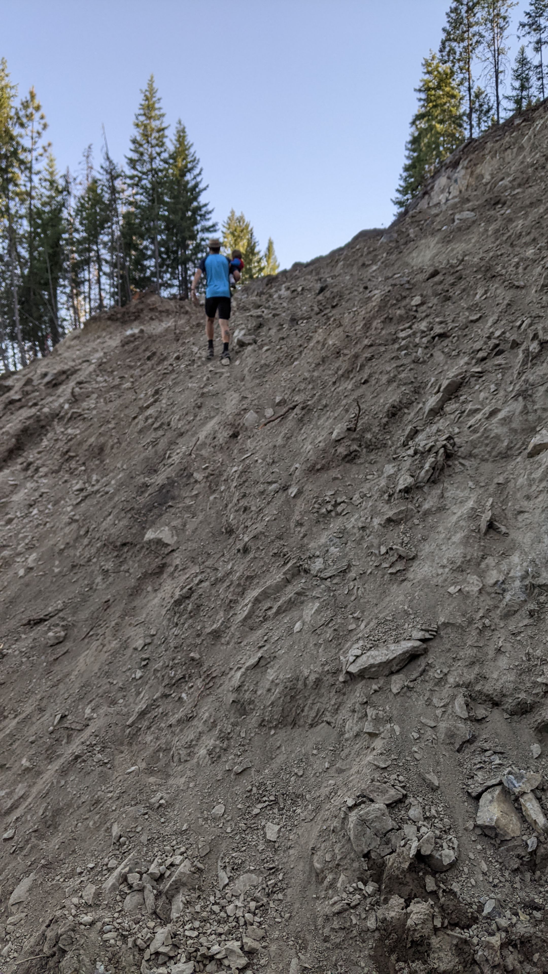
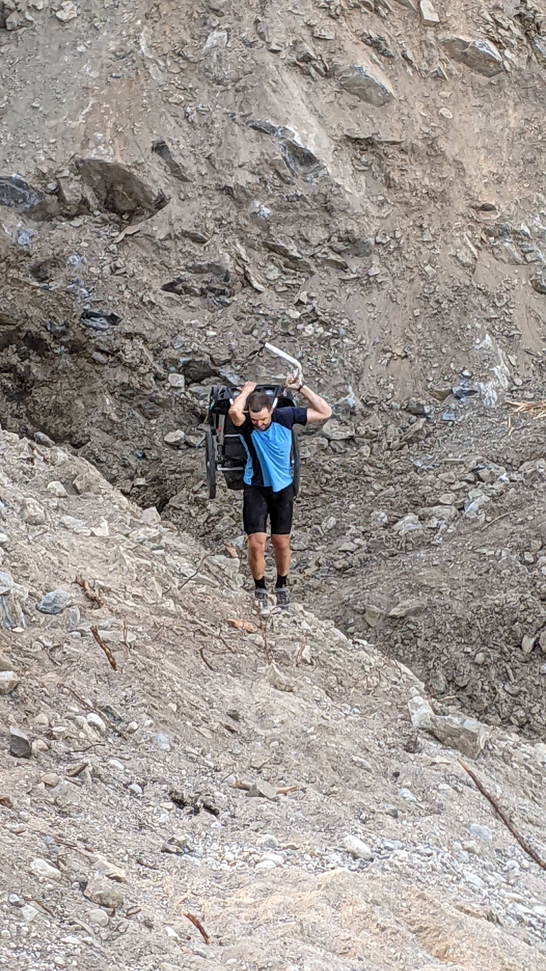
More 🚲!: Our early alarm baby clock meant an early start – we started riding at 7:30am. Today we knew we had a (closed section of trail) landslide to cross. The campground owners had offered us a lift since they were driving an empty utility trailer to Castlegar today, but we decided to try our luck on the trail and see if we got turned around (by people, or, by the landslide itself). We knew yesterday’s family had crossed it (going down, though) and that the construction company shouldn’t be working on it as they can’t run heavy machinery in the heat due to fire hazard. So, we hoisted our bikes over a line of cement blocks, then a log pile wall, then a rock wall. Ryley then carried Axel while I tried to carry my bike (panniers off) up to reccy the mission. Ryley succeeded but I was too sketched out to carry my bike up, so I scrambled up the slope behind Ryley and Axel and hung out on the other side with Axel while Ryley took another 4 trips to carry our 2 bikes, my panniers, and Axel’s trailer across (what a guy!!!). Axel snacked and I cheered Ryley on (when I could see him). It took about an hour to get everything across that 500m section of trail. another rock pile and one more cement barrier to go and we were through, without having to drop back down the Hwy 3 and do a huge and much steeper, and hotter, climb on the side of the highway.
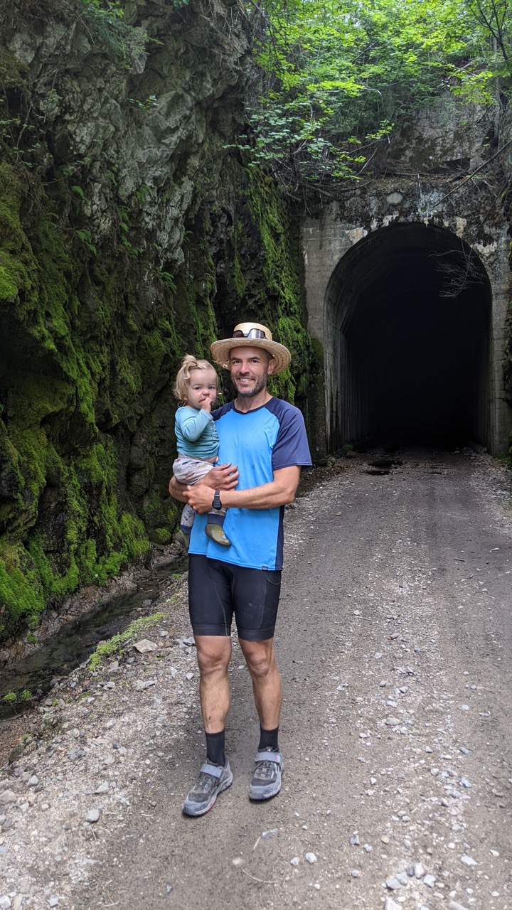
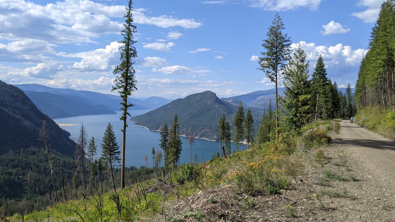
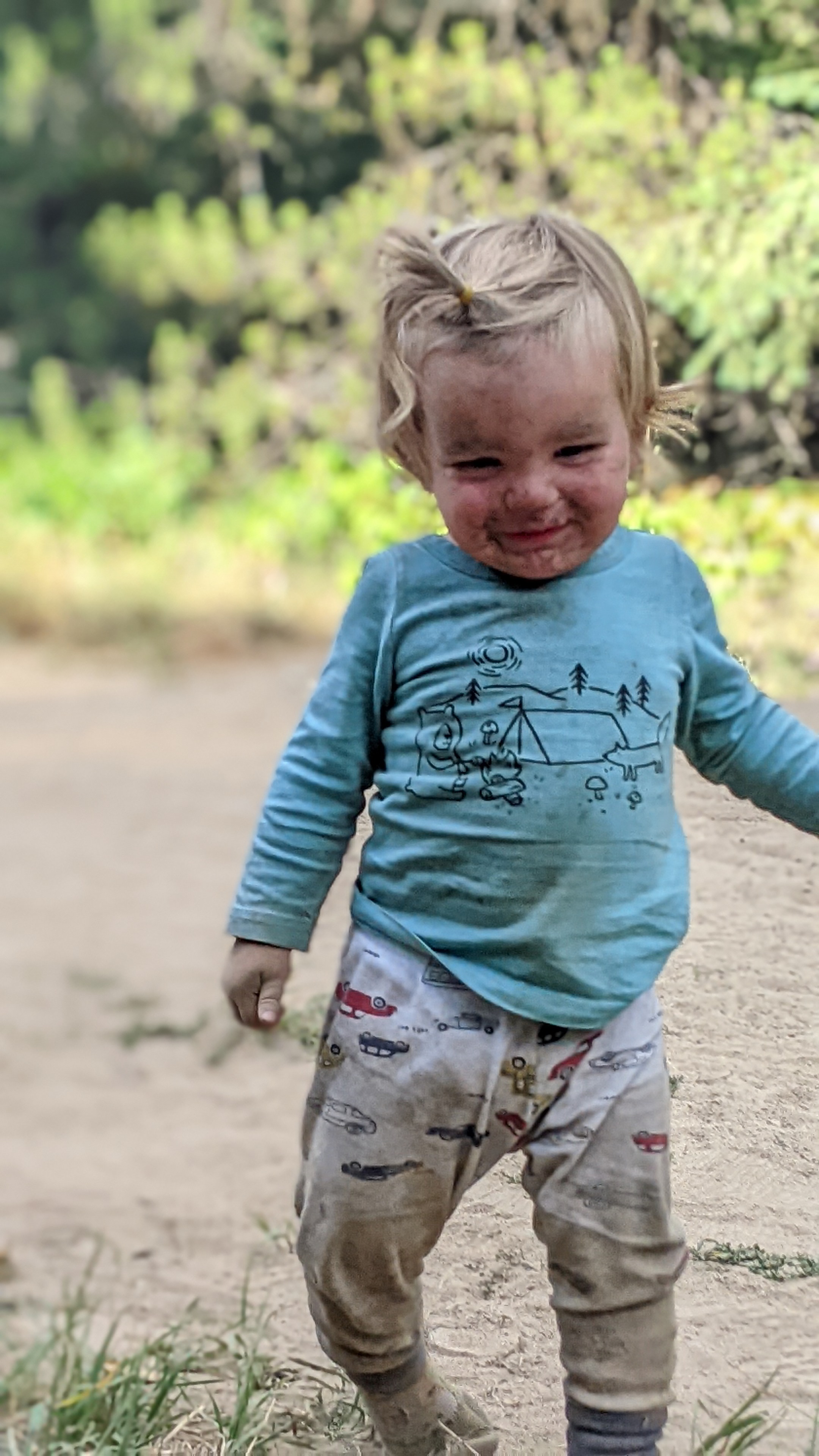
The climb continued up to Farron summit and we got pretty overheated before we hit the top – it was a long and big climb from Christina Lake! We lunched at the summit in one of the nice 3-sided shelters with a poured cement and polished aggregate rock picnic table, always complemented by an outhouse. These were nice features along the way, and often included historical pictures and write ups about the railway, which was neat. We started our descent towards Castlegar from Farron summit, which went through many (long, dark, and sometimes drippy!) tunnels, and carried us along beatiful rail trail above Lower Arrow Lake. We did start to see more traffic on the Castlegar side which also meant for some bumpier trail – we took it pretty slowly on the descent. We were out of water without any great camping spots coming up, so we filtered 8L out of a pipe coming out of the side of a tunnel (it was a surprisingly cold job!). We stopped and camped at one of the shelters which used to be Shields Station, about 15km before Castlegar. Sadly, my first day with no swim or river dips or bird baths – and it was a hot and dusty one! This was also the day that Axel truly discovered chasing ants across the paved shelter floors, and just sat in a pile of dirt pouring handfuls of sand on himself. He also has started loudly exclaiming “ooohhhhhhh” when he sees something he’s really excited about.
Distance: 74.89 km, Elevation Gain: 767 m, Moving Time: 7h 39m